French Guns at Cape Helles
The French Guns at Cape Helles
Updated May 2025
Emily Hyles, who is curator at the Australian War Memorial, has recently visited the peninsula. She walked through Gully Ravine and also visited the French guns at Helles. She has contributed the three images below, which clearly show the undergrowth cleared and the guns being prepared for easier and more formal access. Her guide advised her that there are 6 guns in total, of which 4 are being restored for display. Many thanks to Emily!


Original content on the French Guns
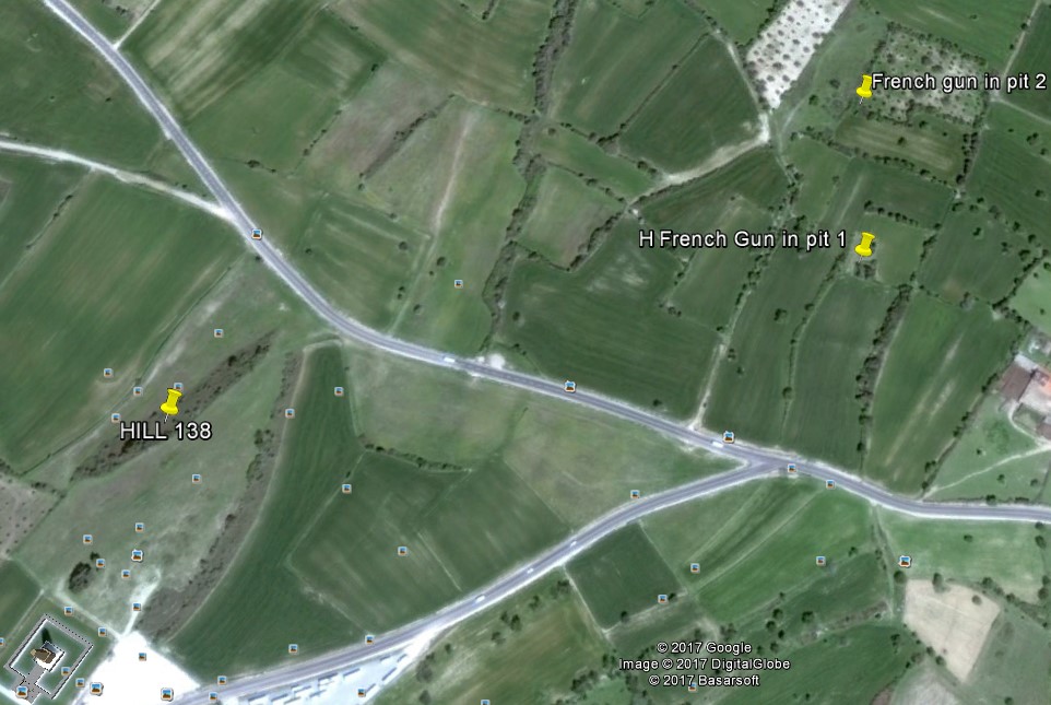
As one leaves the Helles memorial, a sharp left turn at the the main road junction will quickly locate a sign on the right of the road referring to the nearby French guns. (Google Earth screenshot, below). Park by the sign and walk some 200 metres along a rough track to locate the first one, with the other two lying to the left and right. Coordinates for the most central gun to the path are 40.048612°, 26.185596°, and for the further one on the left, 40.049925°, 26.185646° . (Sorry, my GPS device battery ran out at the third gun location to the right but it is not difficult to find with some perseverance).
In the Google Earth screen shot below, the Helles Memorial is at the extreme bottom left.
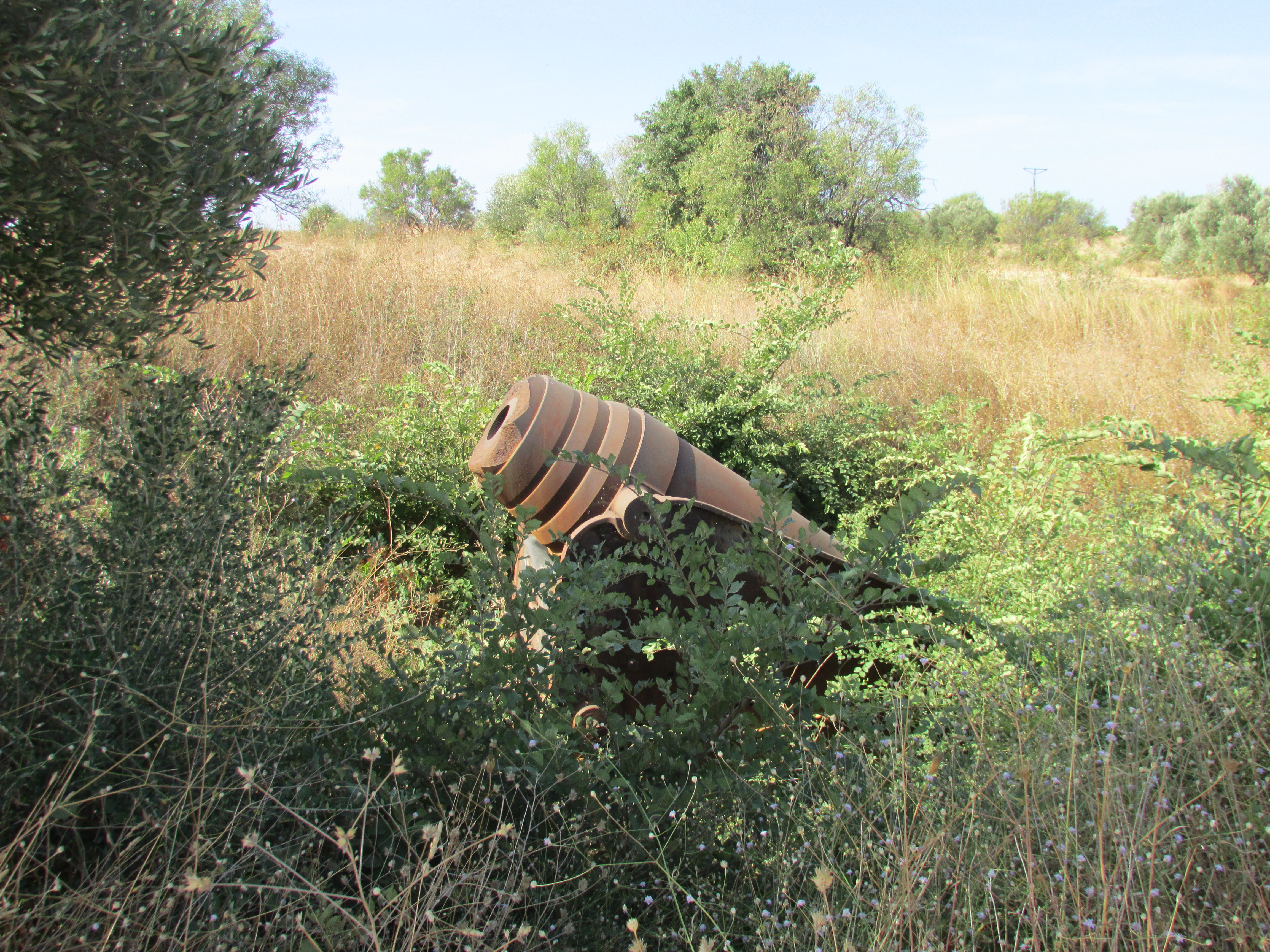
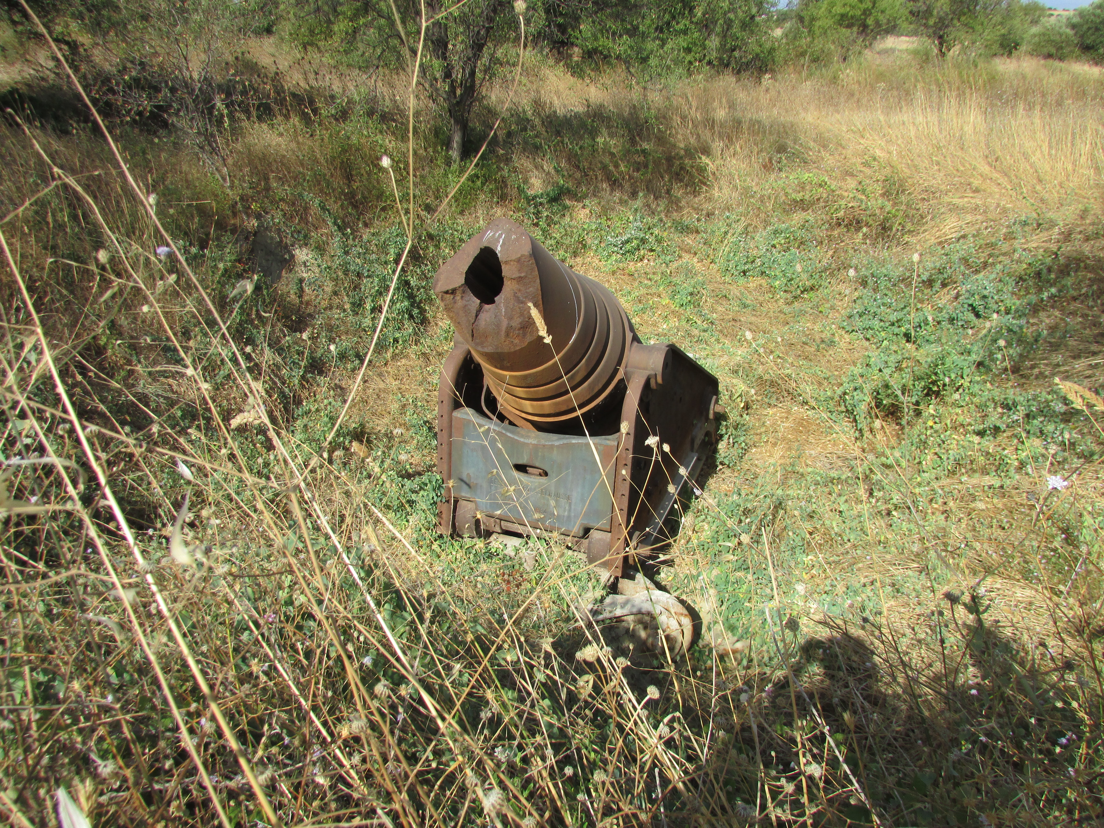
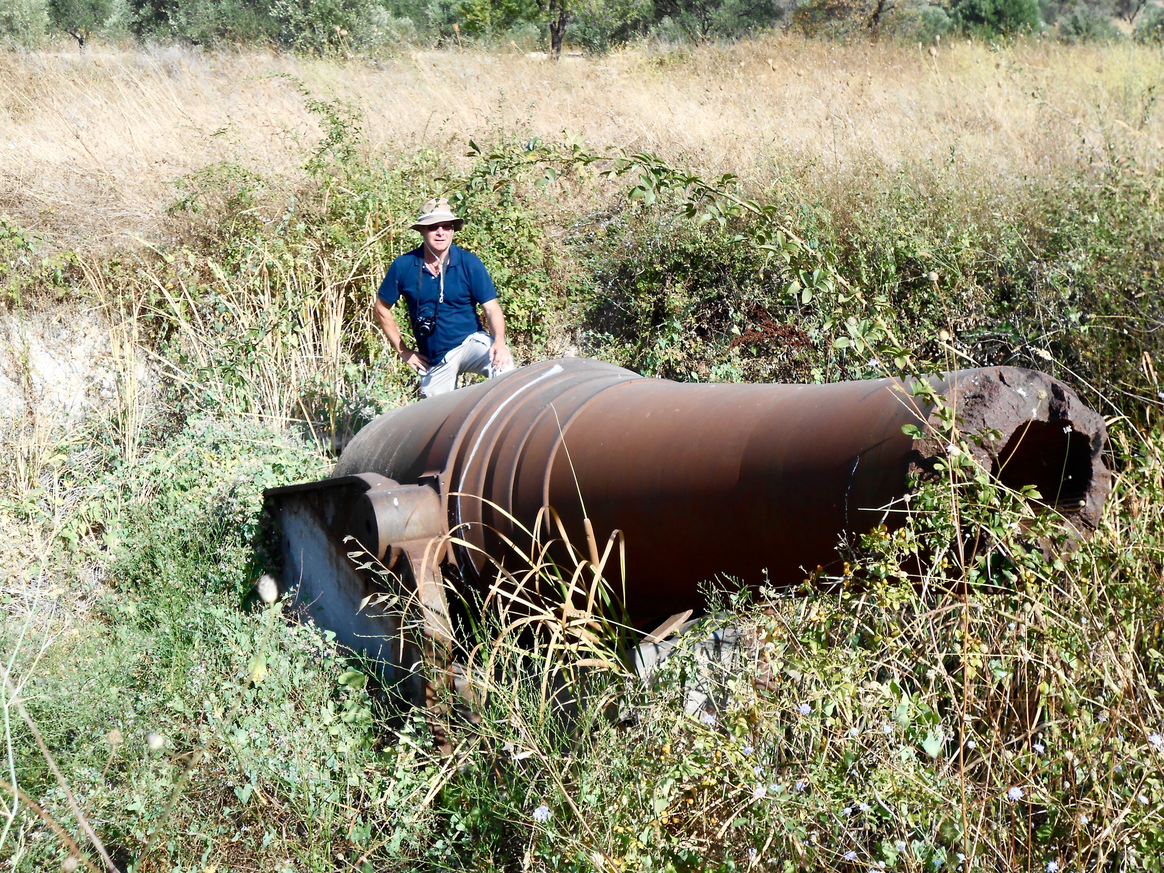
The guns sit in pits and at times of highest growth of the scrub they can be quite difficult to locate, even if you are right next to them.
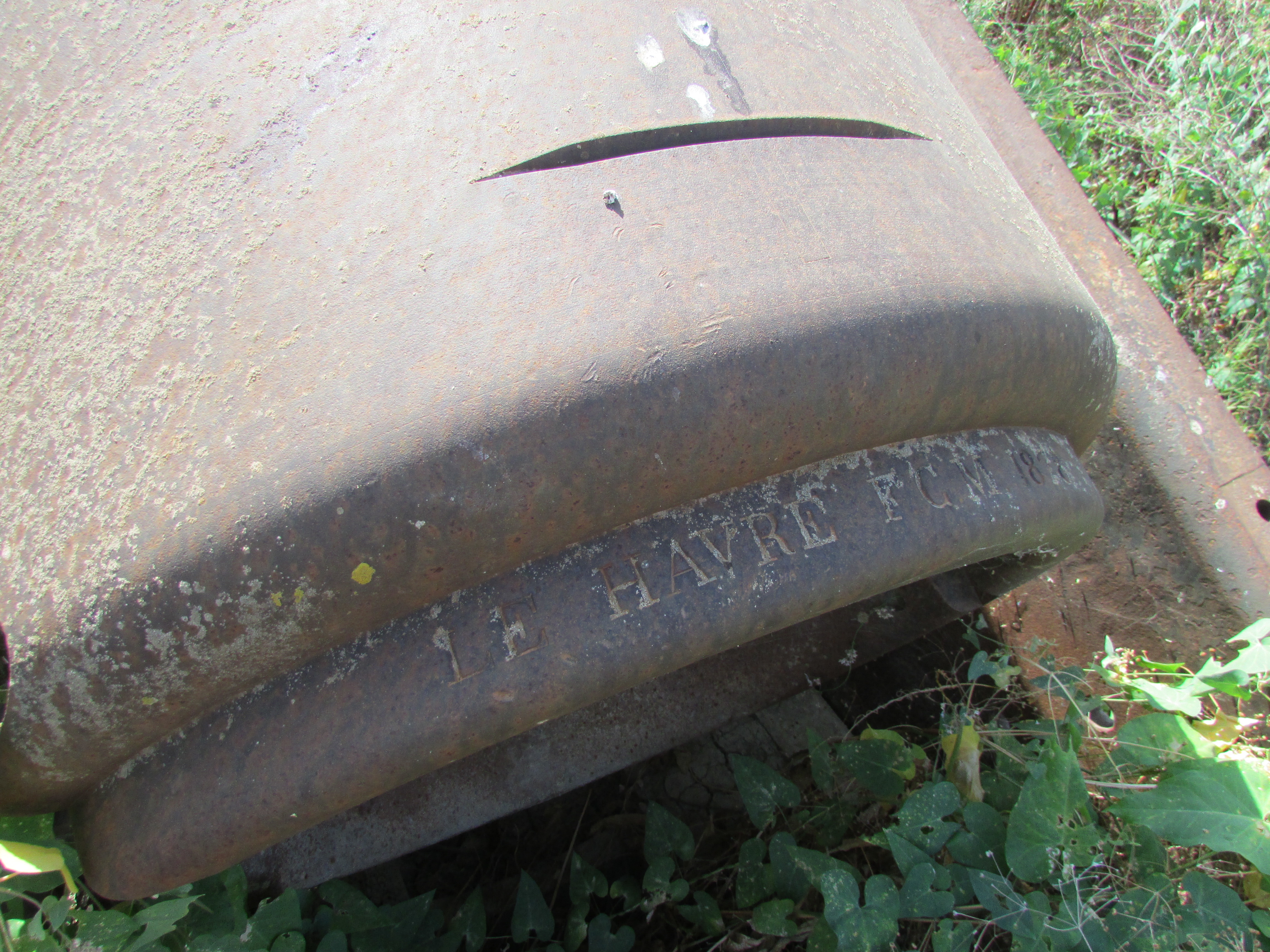
Two have their barrels blown off by explosives.
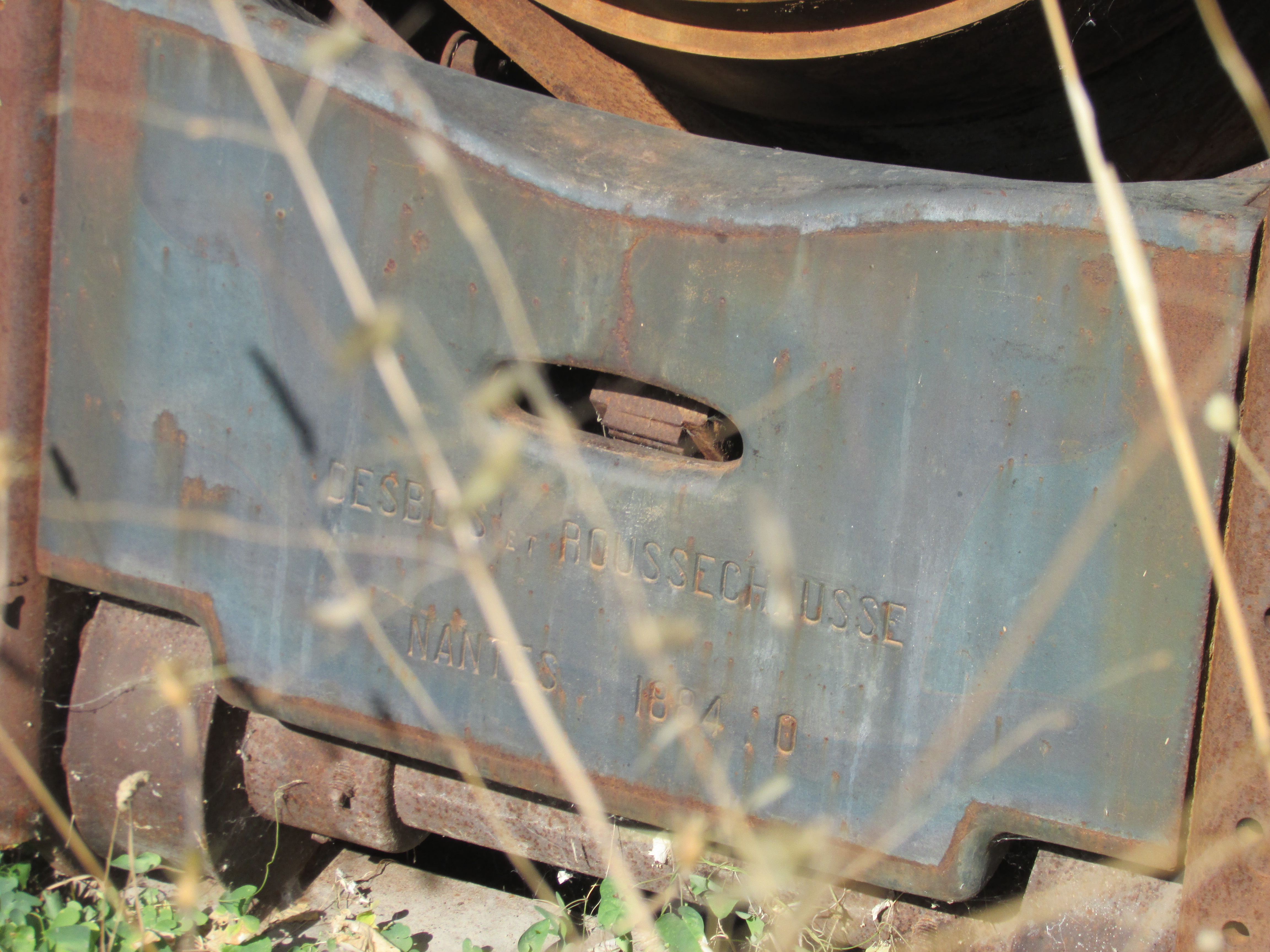
The story is that very soon after the landings on 25 April 1915 the British handed over control of V Beach and its immediate hinterland to the French, and the guns were quickly placed as defensive positions. After the first week of the campaign they were very much behind the advancing front line.